Providing an efficient way to make geological 3D data understandable within minutes.
At its core, Geointercept is designed on a fundamental understanding of geological data workflows, ensuring that the platform speaks the same language as its users and supports real exploration needs. Its development is grounded in geological field work experience, GIS data processing, and the creation of investor-facing visuals. Positioned at the intersection of these disciplines, Geointercept translates complex datasets into clear, structured outputs that support both technical analysis and effective communication. As an independently developed platform, Geointercept avoids unnecessary overhead, allowing for more efficient communication and more accessible pricing.
If you wish to book a demo, discuss a collaboration or simply ask a question, please contact me at nkern@geointercept.com
"While working as a GIS administrator for a junior exploration company,
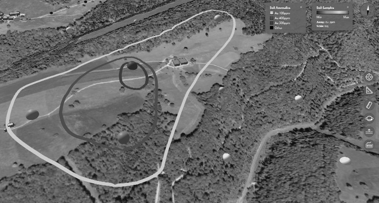
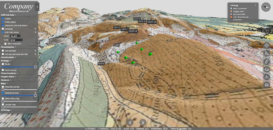
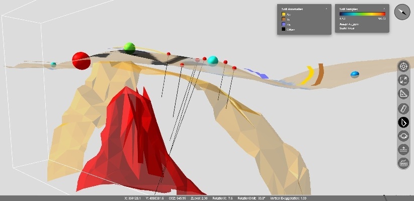
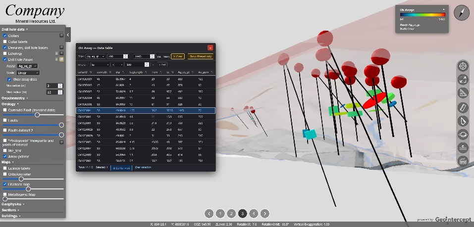
I produced maps, drill hole logs, and cross-sections for reports and investor presentations.
When our CEO asked about presenting geological models and assay results in 3D, I realized our toolkit had reached its limits.
Although we used industry-standard analysis software, we lacked an effective way to share and communicate 3D data.
When a marketing company approached me with a similar request I recognized this as an industry-wide challenge and decided to develop my own solution."